After Vegas we all (Dan and Nat as well) moved on to Death valley, it was a welcome respite from the hectic city.

Camping in Death Valley, Furnace Creek campground - not as extreme as it may sound what with the swimming pool, bar, golf course.....though we didn't get round to using any of them

A sign for Sea Level 300 ft up the hillside, the Badwater basin salt pan is 300ft below sea level and has the highest mean recorded temperature on Earth (though it was't really that hot when we were there - around 85 degrees).

Walking out onto the salt pan, the remains of an evaporated inland sea.


salty crust - soon to be an option at Dominos


We are supposed to be spelling DV for Death Valley but Ralph is not quite supple enough so the result is a DU

Sadly this was not the only golf course in the national park

Devils golf course looked like a ploughed field from a distance but once you looked closely at the salt crystals it was really cool.


in the rough on the golf course

Death Valley was incredibly windy, this meant that much to our disappointment the roadrunners and chuckwallas stayed safely tucked well away from the wind. This was gutting as they were not running around the campsite, as the unusually large rangers (we figure there are less guided hikes in such a hot place) assured us they normally would, so we didn't see either despite spending a long time on the lookout for wildlife.

I think this is Artists Drive

Badwater salt pan as seen from top of Dante's peak
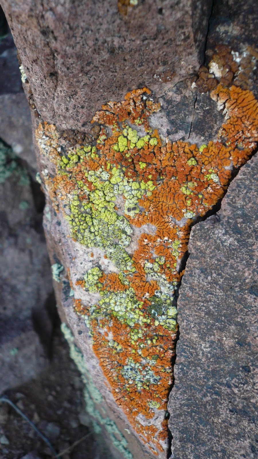
Amazing lichen

some of the rocks actually looked like they had been splatted with paint


Tracks in the sand dunes


The official handover of 'Farkel' a dice game introduced to us by Ruth and Chris in Biggleswade which we'd been playing with Dan and Natasha. We were disappointed that there were no Farkel tables in the Las Vegas casinos. Dan and Natasha are now heading north back to Ottowa, next stop for us, Yosemite National Park via scenic byway 395 along the eastern Sierra Nevada.


Joshua trees on the way out of Death Valley

The Sierra Nevada and Mt Whitney, highest point in the lower 48 and end of the 210 mile John Muir trail which starts in Yosemite. No roadrunners along the roadside but lots of antelope squirrels which stand in shrubs beside the road.
No comments:
Post a Comment